Climbs 128
Rocktype Gritstone
Altitude 425m a.s.l
Faces S
Fiend braving bleak mid-July conditions on Pocket Wall, Standing Stones © Fiend
Crag features
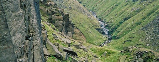
Following the closure of the track to Rimmon Clough, the shortest approach (about 1.5km) is from the Pennine Way car park near the high point of the A635 Holmfirth to Greenfield road though it's rough going over the moor to reach and follow Rimmon Clough beyond which a vaguely visible path goes to the crag top. A longer approach is from Binn Green car park below Alderman, from where it's about 4km. The layby mentioned below is now closed. The crag is south-facing and has a worthy selection of routes though it is inclined to be a little gritty after rain due to the slope directly above the cliff. The chaotic state of the terrain below the cliff reveals that it was formed by a landslip and it has been suggested that Falling Stones might be a better name for the place though the central section of the cliff has stood in its present form for quite a time. However (see note below) in 1919 a section left of Smiler's Corner collapsed so routes between Kathryn's Crack and the butrees bounding Smiler's Corner have gone. That area always looked dodgy with mediocre routes. The rest of the crag was untouched.
The slope above the cliff is not the crisp clean top of the Eastern Edges; care required when setting up belays. Descents can be made round either edge of the cliff - again care required when wearing slick soled boots on grassy terrain.
30 March 2019 - Massive rockfall in the Ning, Nang, Nong, Bong area. Several tons of rock and earth now at foot of the crag.
May 2020 area around Echantillon and Upset at far left side of crag further rock fall. Take care. Greystone Pillar may also be suspect.
Approach notes
If approaching from above the crag, the recommended access has changed since the description in the BMC 'Over The Moors' guidebook. The approach as currently described is an undulating pathless slog, and in anything other than dry conditions anyone going that way would be pretty moist by the time they got to the crag.
Far better, is to walk along the road from the Pennine Way layby westwards for 1km to the gate, walk down the track for a couple of hundred metres before striking off directly across the moor to the crag. Or Head directly from the laybe to Rimmon Clough and follow it down to meet the original track (now blocked) by a gate at the road). Around 1km.
A longer (about 2km) but very scenic approach is also possible from the Binn Green car park - descend to the dam, turn left and follow the left bank of the reservoir to its end, then continue up the valley bottom until the crag is visible on the left. A steep walk up the slopes above takes you to the base of the crag.
No Access Issues
'Private Land' signs have appeared at some points along the boundary with the A635 road which has led to some confusion over whether access is permitted or not. This land is designated as Open Access and the public have a full legal right to access is for recreation on foot, including climbing. Please keep dogs on a lead to help avoid future difficulties.
June 2020 update: the unstable pillar at the left side of the crag (mentioned in Over the Moors) appears to have fallen down. Caution is advised in this area as there appears to be some loose rock remaining on ledges etc.
|
Climbs at this crag
| Name | Grade | Stars | Type | Logs | Partner Ascents |
|---|
These climbs you have climbed by seconding or top-roping.
These climbs you have Dogged.
These climbs you Did not Finish.
Climbs are waiting to be checked by a crag moderator, and may not be accurate. Climbs can't be verified by a crag moderator, and they need more information to confirm it. Climbs are no longer climbable.
Moderators Updates to this page are checked by UKC volunteers ste_d and nickcanute